Tag Archives: Gualala River

2 Comments

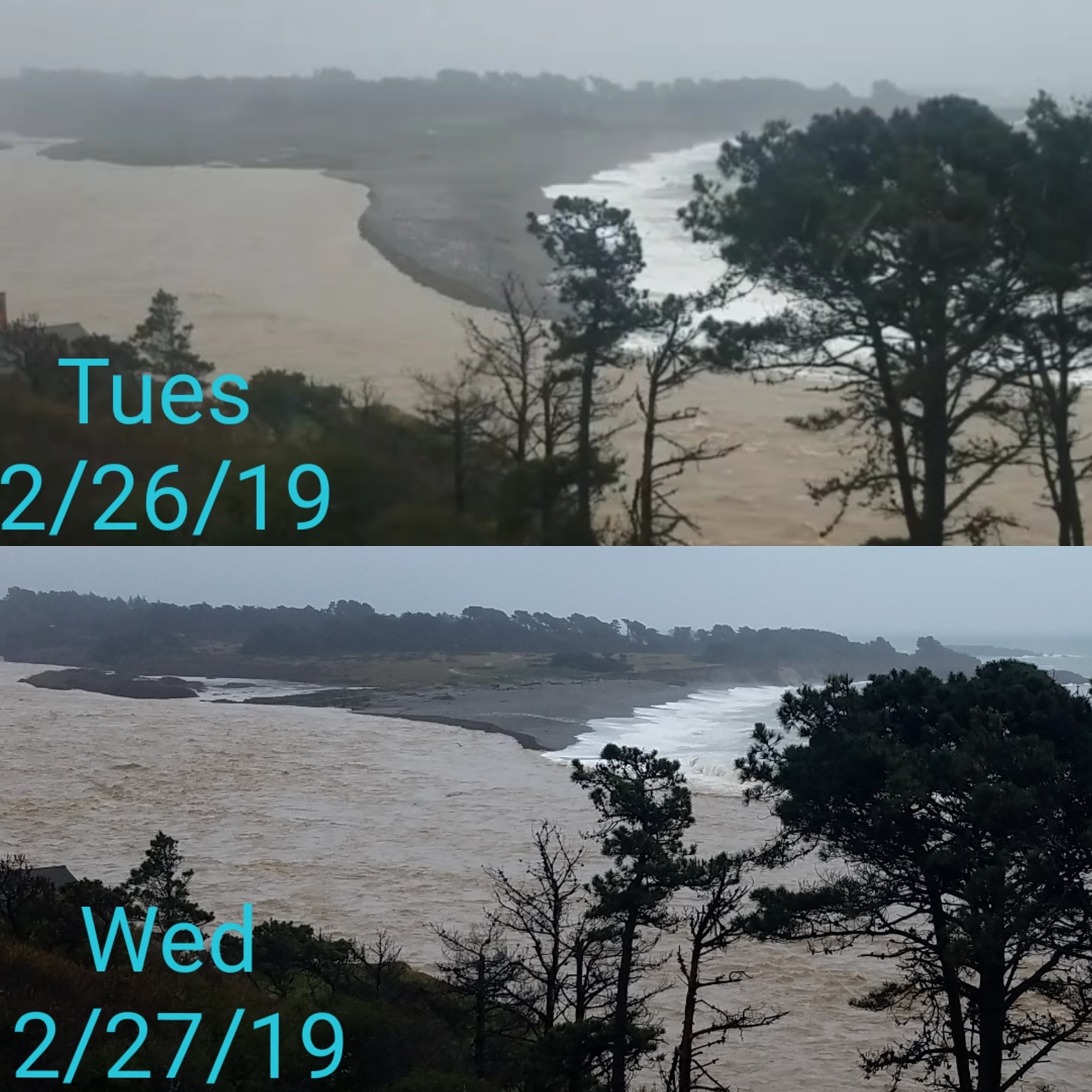
Julie Bower photographed the Gualala River on Tuesday and again this morning. After the river-of-rain deluges on Monday and Tuesday, the river full to the brim. By Wednesday morning the river was flowing completely over much of the sandbar.

So far, so good when it comes to this river. Other rivers, especially the Russian River, are flooding badly today. We received 9.60 inches from this rain event, bringing us to 47 inches season to date.

Thanks to Julie for allowing me to share her photos with you here.

Many roads are either flooded or blocked by landslides. With the Garcia River flooding Highway One north of Point Arena, and other roads south of Point Arena closed, we are effectively blocked on the coast today. If you are thinking of coming here, best to wait a few days.

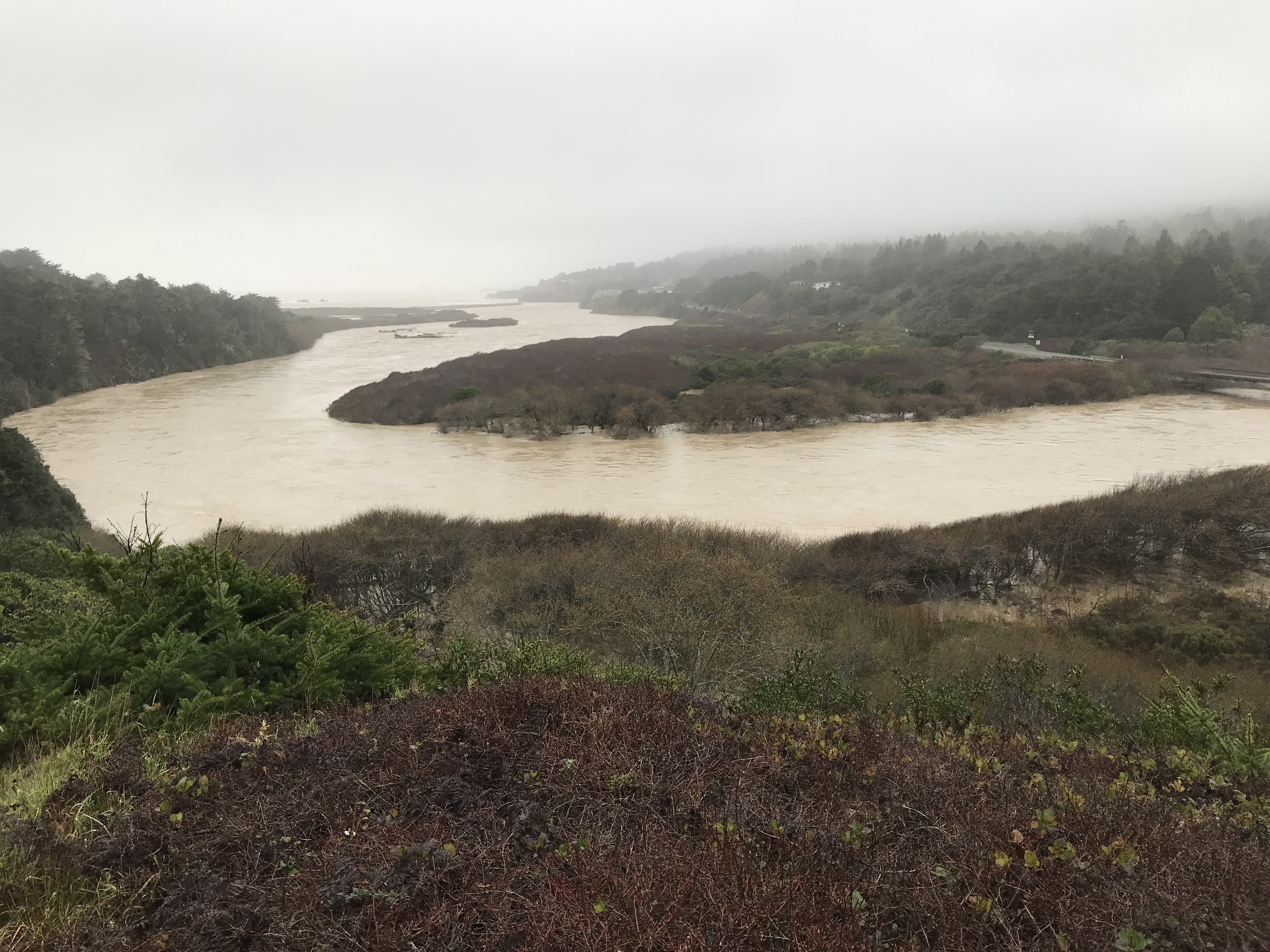
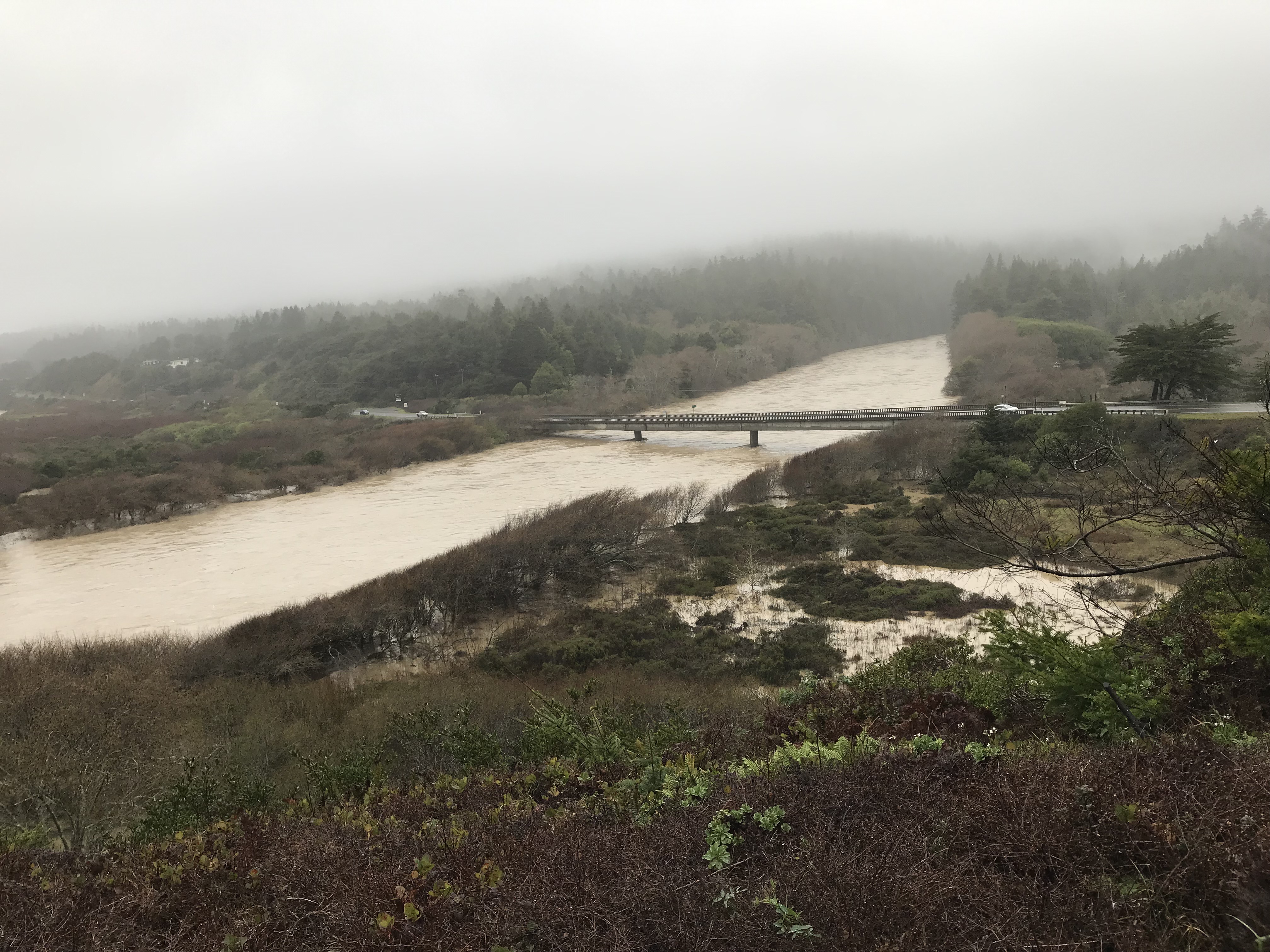
Rick and I ventured out into the storm to take a look at the Gualala River. We received 4.55 inches of rain yesterday, and the watershed received much more. Here's what it looked like around noon today.

The Gualala River Bridge has never flooded, according to local expert Steve McLaughlin. Steve said in the early 1980's it came within a few feet of the bridge deck, but it didn't flood. It's not expected to flood during this storm either. But here's a look at it - I took these photosfrom the bend in the road at Gualala Point Regional Park.

Highway 1 is closed north of Point Arena due to flooding of the Garcia River. You can get reports on this closure at this Facebook page: https://www.facebook.com/groups/236967076730512/

As this morning, we have received 42 inches of the wet stuff - rain! - season to date. No drought here, not this year. Hooray!

Bob Rutemoeller went down to the Gualala Bluff Trail to assess how it fared during the big storm. Nearly three inches of rain fell within 36 hours. The Trail was unharmed but Bob found the river strongly flowing out to the Pacific Ocean.

Here you can see the sandbar is almost completely covered with the raging river.

We have more rain today and another storm for tomorrow, Sunday. Then there will be a stretch of mild, sunny weather - the perfect time to be on the Mendonoma coast.

Thanks to Bob for allowing me to share his photos with you here. To learn more about the Gualala Bluff Trail, here is the website of the Redwood Coast Land Conservancy: http://www.rc-lc.org/

You can also learn about the other Coastal Access spots under their auspices. I'm a big fan of RCLC and enjoy the Trail, Cooks Beach and Hearn Gulch on a regular basis.

We took a walk on the Gualala Bluff Trail this morning, marveling at the big surf. The skies are blue and the Gualala River is flowing out to sea.

The forecast calls for lots of rain, but you couldn't tell by today!

Last Thursday the Gualala River was muddy and much higher due to storms.

Harbor Seals and Gulls at the Gualala River by Jeanne Jackson

Here is a short video. There were nearly 100 Harbor Seals hauled out on the sandbar. There were also many Gulls, some in the river washing themselves. Others were drying out on the sand. It was fun to watch the Gulls being drawn closer to the river mouth and then flying up and back into the river to be carried along by the current once again.

Mike Nelson piloted his drone and photographed the Gualala River recently. You can the big sandbar that finally was breached with the rains. The buildings are the small town of Gualala. The river opened a little differently this year, angling to the south as it flows into the Pacific Ocean.

It's very interesting to see the Gualala River mouth from the vantage point of a bird...or in this case, a drone!

Thanks to Mike for allowing me to share his photo with you here.  Mike is the owner of MD Electric and Solar. If you ever need his services, here's a link to his website: http://mdelectricsolar.com/

More rain today and the ocean is roaring!