Bonny Dunn piloted her drone out over the Pacific Ocean to get this view of the coastline. It was at the peak of the recent King tides.
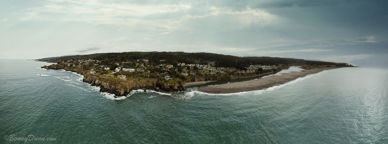
You can see the Gualala River flowing into the ocean and the town of Gualala in the middle. What a fascinating look at our area.
Thanks to Bonny for allowing me to share her photo with you here. To see more of Bonny's photography, here is a link to her website: https://bonnydunn.com/
We had a break from the storms today, Tuesday, but another storm is coming in tonight. Clouds are piling in! The last storm brought 2.50 inches, bringing my season to date total to 29.95 inches. 50 inches is a "normal" year at Rick's and my place, so we are well on our way!