Tag Archives: Scott Gasparian

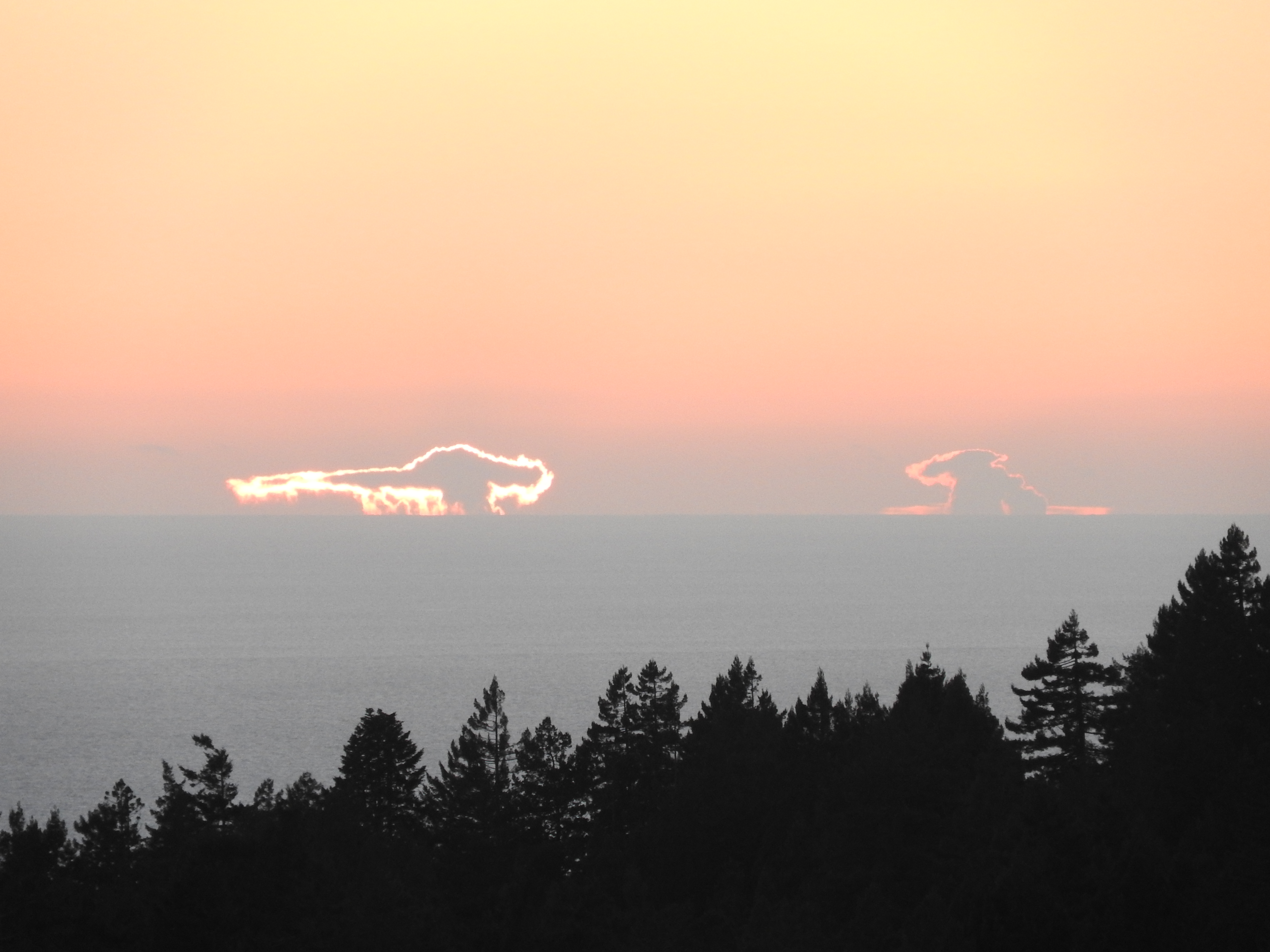
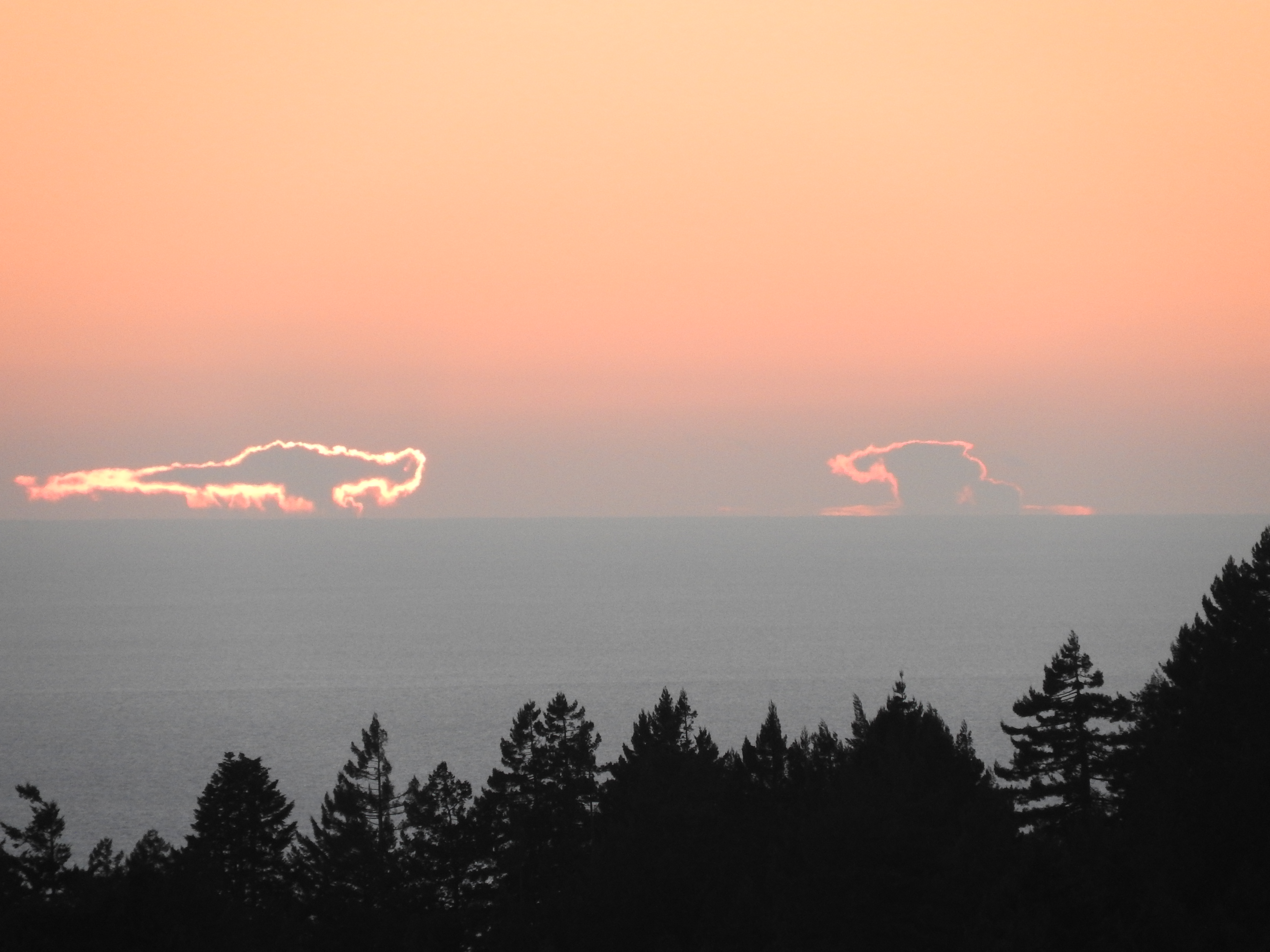
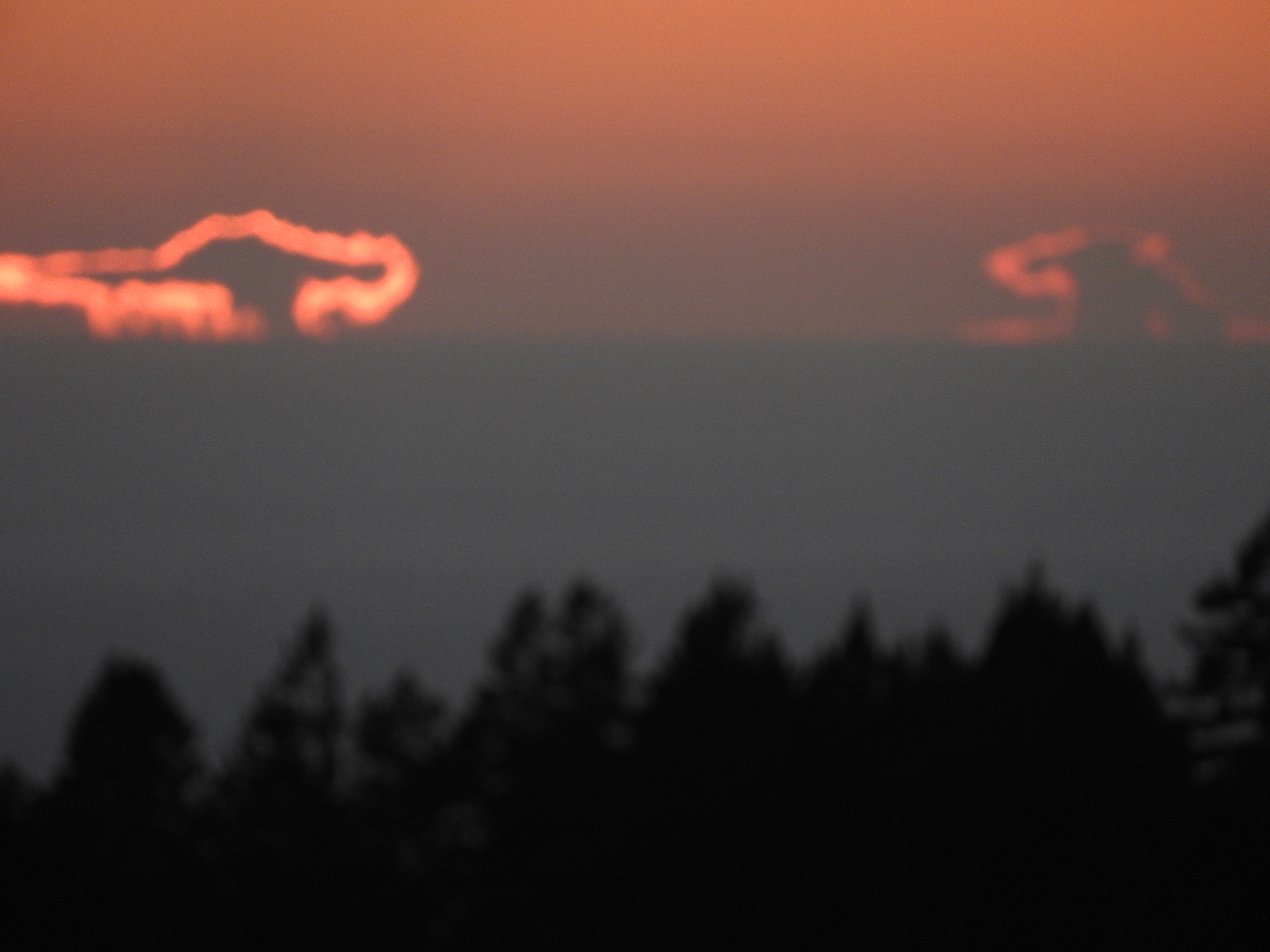
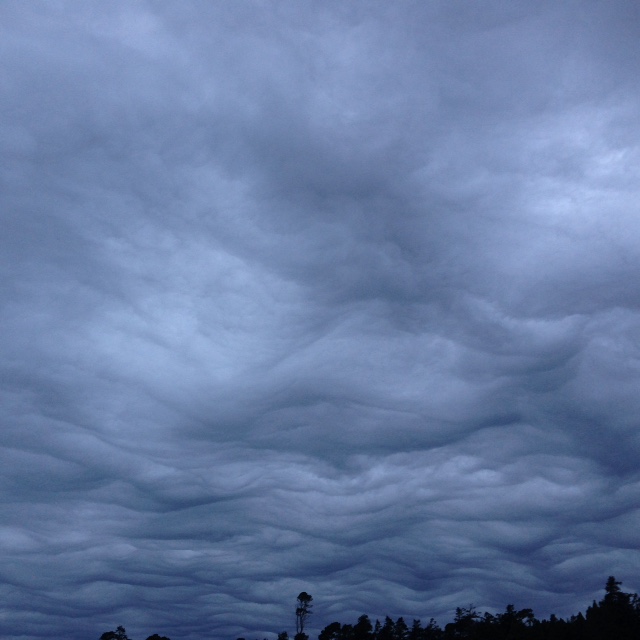
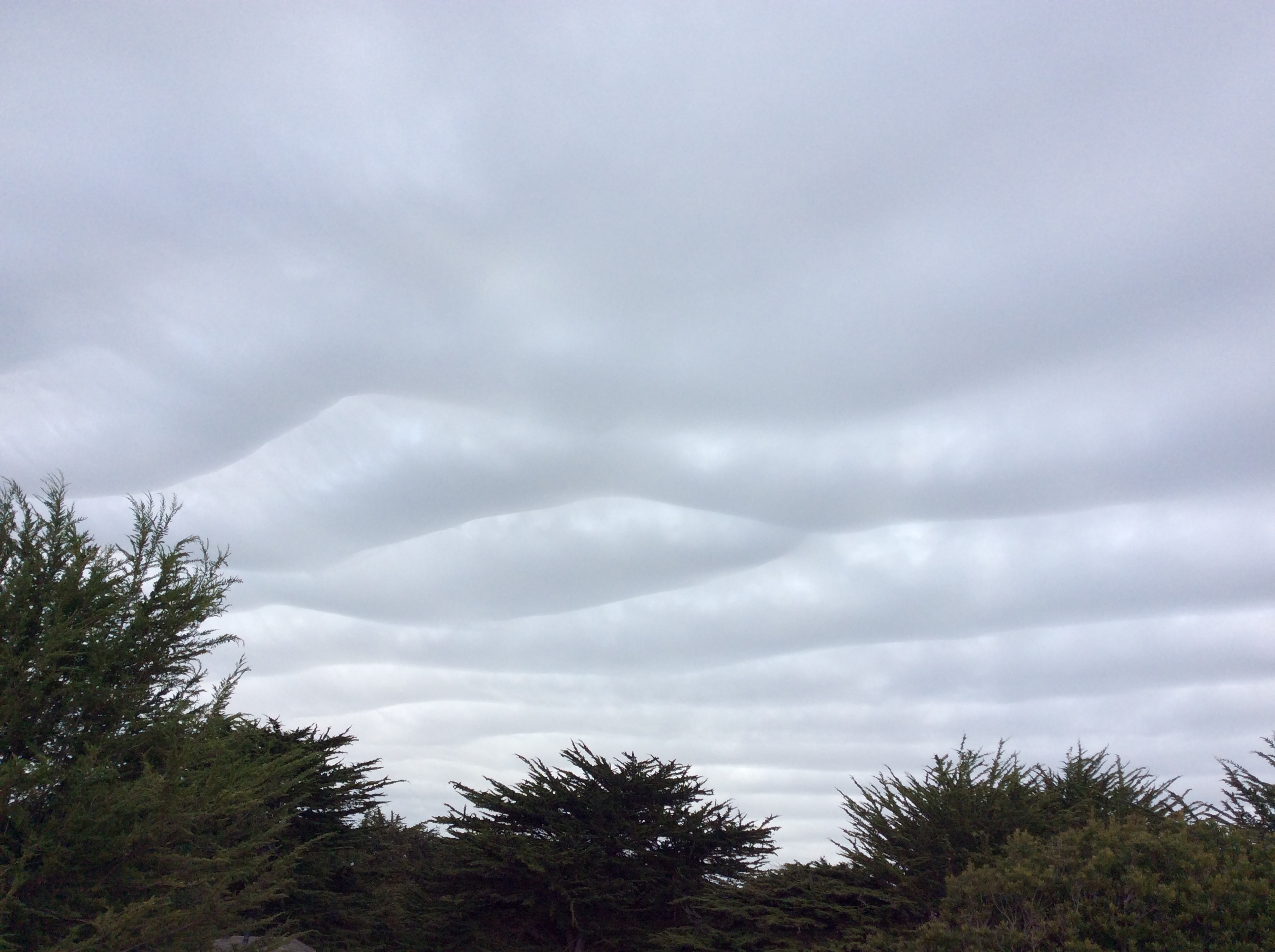
The trouble-making thunderstorms California experienced last month brought an unusual cloud formation over the Pacific Ocean. Ned Alpers called it a “cloud-island.”

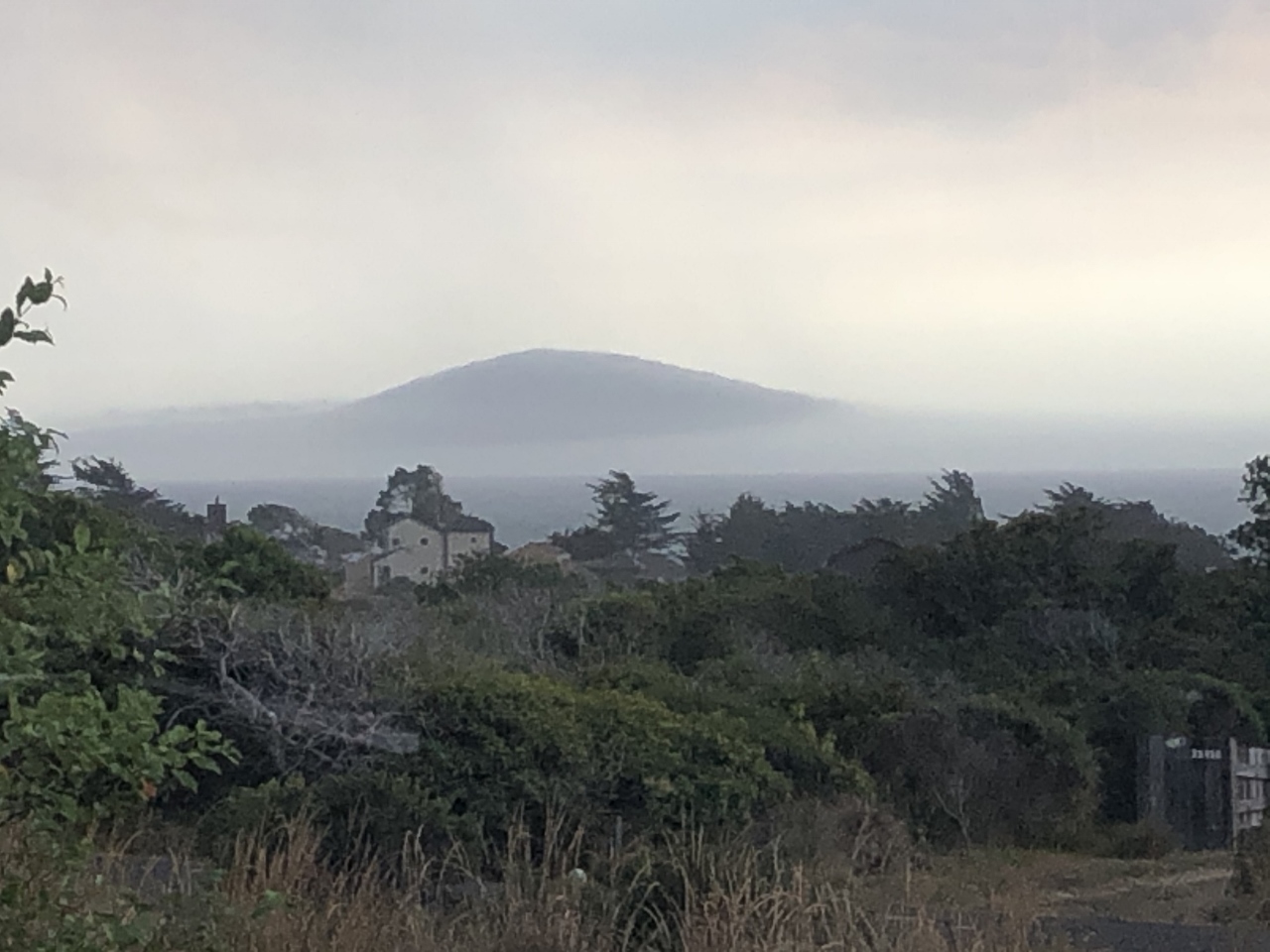
Jim Garlock saw it in Gualala and wrote, “I just looked outside and thought a new land mass had sprung out of the ocean. It was a cloud that has now disappeared, but it was certainly a strange view.”

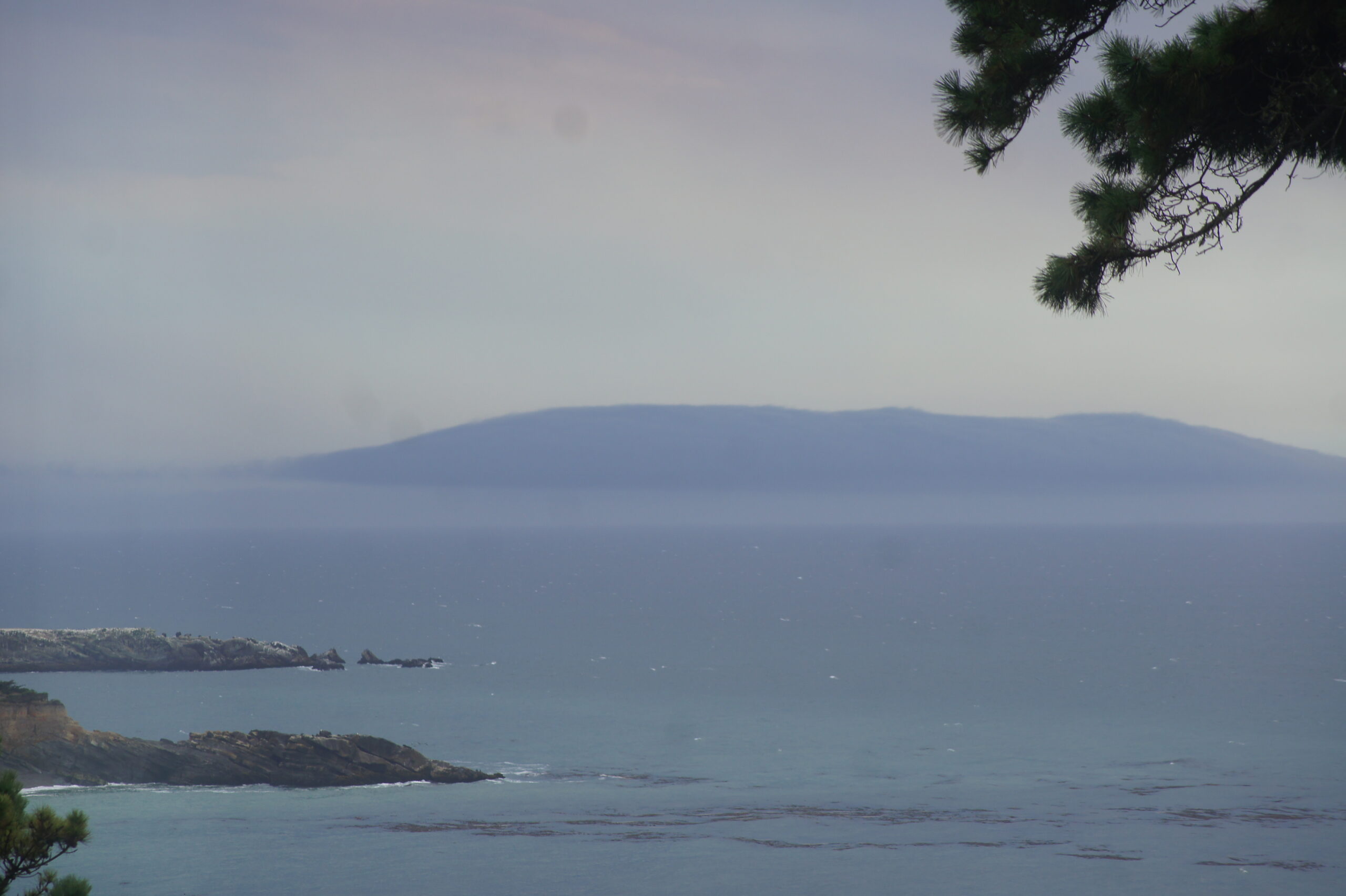
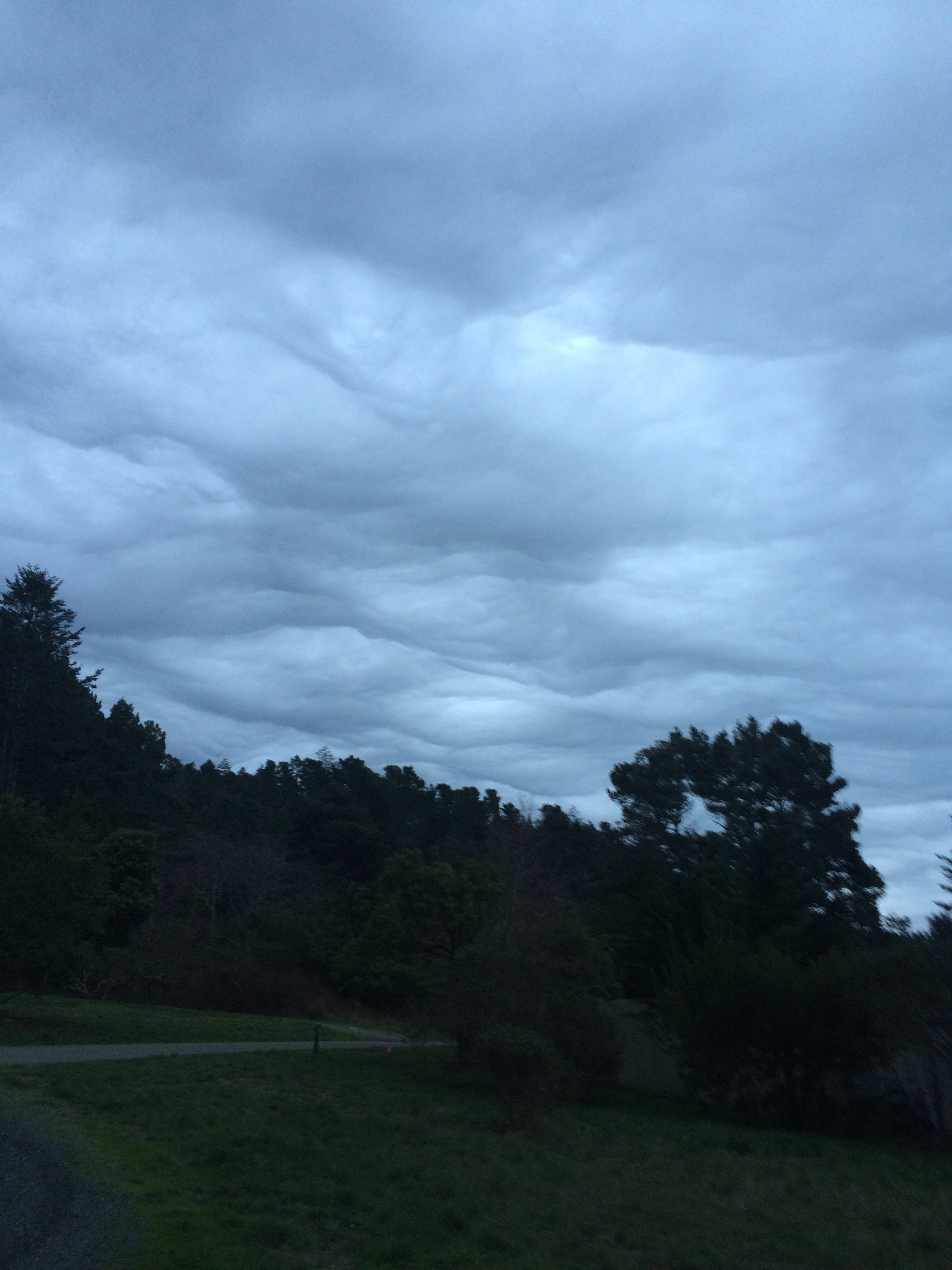
John Wall saw it too. He wrote, “I saw this really interesting and unusual cloud formation as I was driving south by Stewart’s Point. It was worth pulling over to take a pic even though it got me stuck behind a Winnebago that wouldn’t pull over! [The cloud formation] made me want to dial up “Islands In the Sky.’ What an amazing place we live in!”

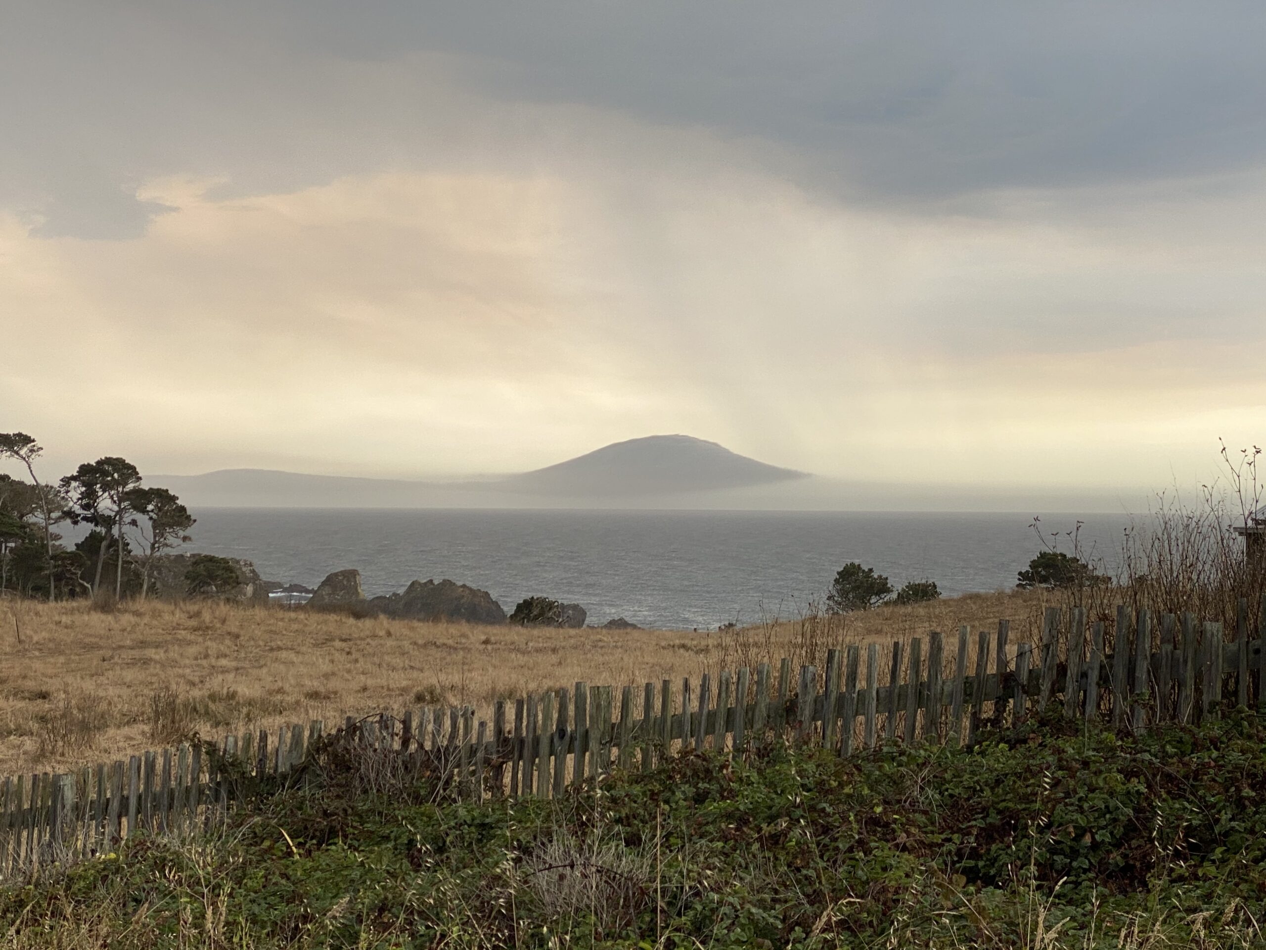
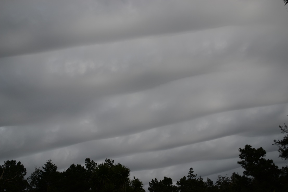
Scott Gasparian took a look at the photos and sent me several links that explained this rare phenomenon. It was a type of Arcus cloud called a Roll cloud, or a Morning Glory cloud. They can be created by downdrafts of thunderstorms.

Thanks to John, Jim and Ned for allowing me to share their photos with you here.

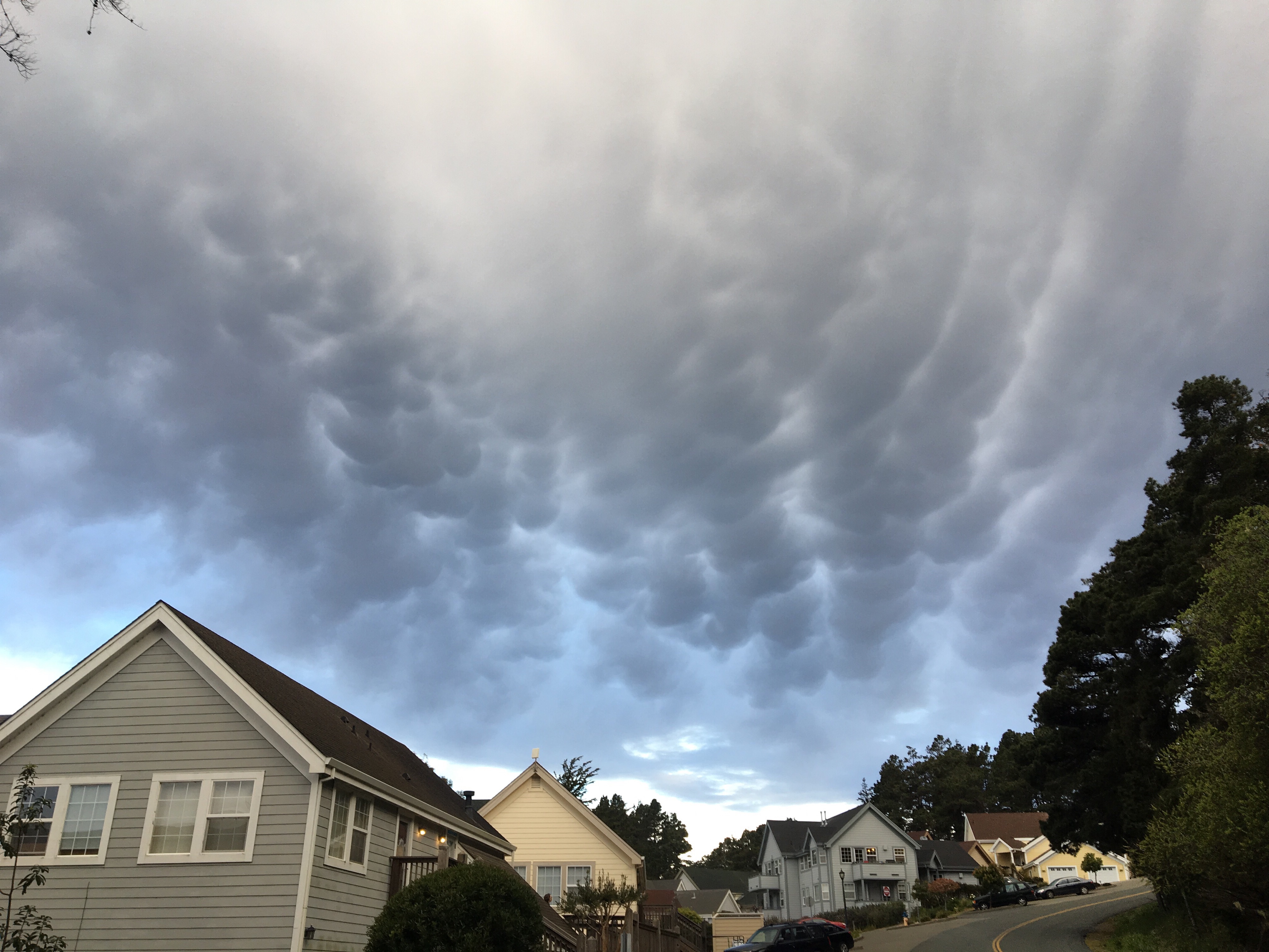
Heat wave on the Mendonoma Coast! Might I tell you I do not like the heat? It's nearly 30 degrees hotter today than yesterday. At our home in Anchor Bay we are at 90 degrees this afternoon.

2 Comments

Sunset watching is a coast tradition; Rick and I try to always take the time to watch it. Several weeks ago I thought I was seeing a double sunset.

I queried Scott Gasparian about my photo, wondering if this was some kind of mirage. He wrote, "I see two super Cumulonimbus cloud cells, with anvil tops. The anvil top means they are very tall, like 40,000 feet at least, so can be seen way far away, and catch the sunlight they are closer to the sunset.

One must be in front of the sun, and the other off to the side. Mirage they would be the same, like mirror, they are different. Look careful and can see the rain and virga catching the light too. Good shot there."

As the sun set, I got this photo with my long lens - I know, it's a little out of focus but still pretty cool to see. The sun set behind the storm cloud on the left.

I hope you enjoy my unusual sighting!

We started off the day near the coast in wet, drippy fog. The sun came out this afternoon. Humpback whales are still being seen, always an exciting sighting.


Peggy Berryhill noticed these unusual clouds a few weeks ago. Scott Gasparian identified them as mammatus clouds, often a predictor of wild weather.

Scott wrote, "When I used to fly paragliders cross county, I found there are two sizes of clouds: those that are small and fed by an updraft, and those that get big enough to internally generate lift. We refer to the second type as 'cloud suck.'

"The normally flat bottom of the cloud starts to dome upwards as the freezing/cooling water in the clouds starts to accelerate. When the vertical column reaches up far enough to get into the really cold air zone, then we get hail, and thunder and lightning.

"If it keeps getting higher, with enough warm wet air to feed into it, tornadoes and waterspouts can spawn. If you see mammatus, and they start to rotate, duck. If moving away from you and rotating, sound the alarm. I lived in flat Missouri for a while and have seen two tornado starts, and a bunch of almosts, scary thrilling power to behold."

We Mendonomans will stick to a little hail and lightning, thank you very much.

Thanks to Peggy for allowing me to share her photo with you here, and thanks to Scott for teaching us about mammatus clouds.


2 Comments


On January 21st unusual clouds filled the sky. I had never seen anything like this before. Many coast residents photographed the event. These photos were taken by Don Spear,Pat Maxwell,  Michael Alexander and Shirley Mitchell respectively.

Unusual clouds by Don Spear

Unusual clouds by Pat Maxwell  Unusual clouds by Michael Alexander Unusual clouds by Shirley Mitchell

Here's what I wrote in my weekly column in the Independent Coast Observer:

Many people noticed the incredible clouds last Thursday. Justine Rosenthal’s class at Horicon School was amazed. One student said, “Look, we’re underwater!”

Michael Alexander saw them too. He wrote, “I looked up and saw these interesting cloud contours overhead. It looked almost like the surface of a very plush mattress.”

Pat Maxwell wrote, “The clouds were eerie and amazing. They reminded me of a Van Gogh painting. And for those of us who see faces in clouds, they were fascinating.”

Rick and I saw them over Gualala and we couldn’t believe our eyes. Shirley Mitchell was one of many to photograph the event. She wrote, “The clouds look like the ocean and/or sand dunes. I have never seen a sky like this. Wonders are always around us!”

Scott Gasparian knew what they were. He wrote, “They are pre-frontal strato-cumulus, with orographic forcing. In other words, the coast hills cause the waves. [There has] to be strong winds above the stratus layer to do that.”

It was an amazing sight to behold! Thanks to Pat, Don, Michael and Shirley for allowing me to share their photos with you here.

The wind has shifted this afternoon and the coast cooled off. Yesterday it was an unbelievable 81 degrees at our house. We may be headed back to winter soon, but no rain in this week's forecast.