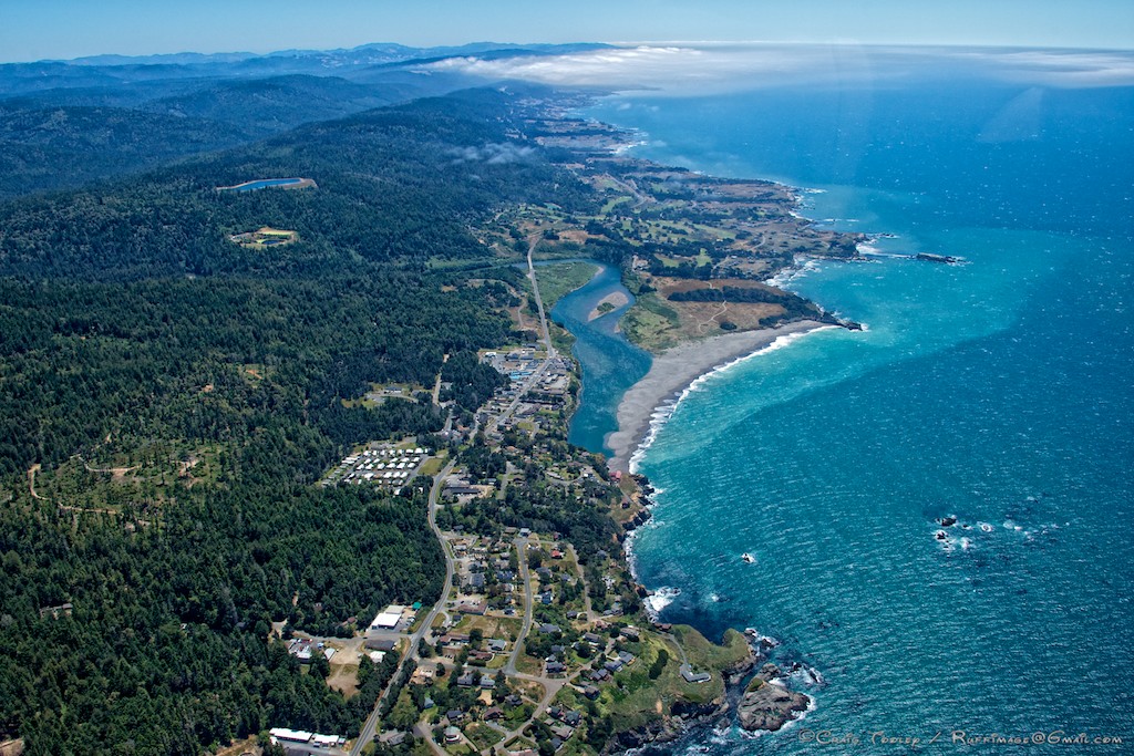
Nothing beats a bird's eye view! Craig Tooley took to the air to photograph the nesting seabirds on Gualala Point Island and Fish Rocks. He also photographed the town of Gualala, which you can see in the bottom half of the photo. You can also see the Gualala River, which is currently closed to the Pacific Ocean by its summertime sandbar.

The Gualala River is the dividing line between Mendocino County and Sonoma County. The Sea Ranch stretches along the northern Sonoma Coast at the top of Craig's photo. It's a beautiful part of the world, don't you agree?
Thanks to Craig for allowing me to share his photo with you here. To see Craig's wildlife and aerial photography, here is the link to his web site: http://ruffimage.com/